

 Flood Hazard Area Bylaw
A Flood Hazard Area bylaw is required by FEMA to ensure that the Town of Sharon, its citizens and businesses will be eligible for federal flood insurance, federal disaster recovery funds, and hazard mitigation funds as a result of flood damage. Its main purpose is
to avoid loss of life and minimize loss of property, disruption of commerce, impairment of the tax base,
and the extraordinary public expenditures and demands on public services that result from flooding.
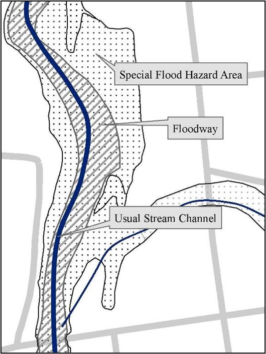
The Bylaw regulates development in two flood hazard areas: 1) The Floodway (aka Fluvial Erosion Hazard Area or River Corridor) is the channel of a river or brook plus the adjacent land that is needed to accommodate the flood waters. 2) The Special Flood Hazard Area has special flood, mudflow, or flood-related erosion hazards and is defined by FEMA maps. The two hazard areas can overlap. Flood maps for the Town of Sharon are currently being updated by FEMA and the Vermont Agency of Natural Resources to reflect the most recent data and flood modeling.
The Flood Hazard Bylaw applies to the mapped areas along the main stem of the White River and its major tributaries: Broad Brook, Elmers Brook, Fay Brook, and Quation Brook. The Bylaw also applies to lands within 50 feet of Broad Brook, Mitchell Brook, High Pole Branch (upstream to Carpenter Road), and Honey Brook (upstream to Howe Hill Road); and within 25 feet of all other perennial streams as measured perpendicular to the top of the stream bank.
Flood Hazard Bylaw and New Construction
Prior to beginning any new construction, landowners along the White River or any perennial brooks and streams, no matter what their size, are advised to read the Flood Hazard Bylaw and view the maps at the Town Offices or online.
Geo Honigford, Administrative Officer for the Town of Sharon, is available to provide guidance: ninefingergeo@gmail.com or 802-359-3027.